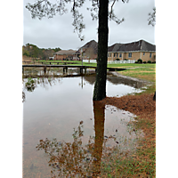
Mariner’s Pointe neighborhood , Chesapeake
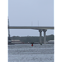
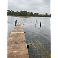
Mid November high tide and Storm event
Mappings
- Chesapeake in Hampton Roads Great bridge lock Road
- Chesapeake, Virginia
- 23322
Mapping data
The Export feature is unavailable
Event Information
- This man thing is to map the mid November high tide and Storm event November 15 through the 17th
Event Details
-

Mid November high tide and Storm event
Starts 11/15/2019 at 7:00 AM EST
Ends 11/17/2019 at 6:00 PM EST
Chesapeake in Hampton Roads
Recent Activity
November 17
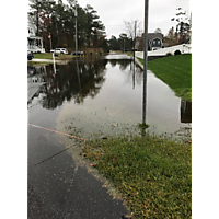
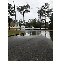
Evan Carmody @Mid November high tide and Storm event posted a photo: Captured point (Captured points)
6 years ago
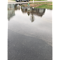
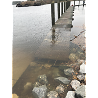
Evan Carmody @Mid November high tide and Storm event posted a photo: Captured point (Captured points)
6 years ago
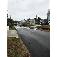
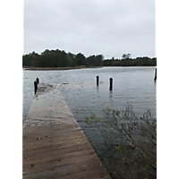
Evan Carmody @Mid November high tide and Storm event posted a photo: Captured point (Captured points)
6 years ago
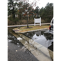
Evan Carmody @Mid November high tide and Storm event posted a photo: Captured point (Captured points)
6 years ago
Evan Carmody @Mid November high tide and Storm event posted a photo: Captured point (Captured points)
6 years ago
Evan Carmody @Mid November high tide and Storm event posted a photo: Captured point (Captured points)
6 years ago
Evan Carmody @Mid November high tide and Storm event posted a photo: Captured point (Captured points)
6 years ago

Evan Carmody @Mid November high tide and Storm event posted a photo: Captured point (Captured points)
6 years ago
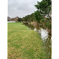
Jessica Carmody @Mid November high tide and Storm event posted a photo: Captured point (Captured points)
6 years ago
Jessica Carmody @Mid November high tide and Storm event posted a photo: Captured point (Captured points)
6 years ago
November 16
Jessica Carmody @Mid November high tide and Storm event posted a photo: Captured point (Captured points)
6 years ago
Jessica Carmody @Mid November high tide and Storm event posted a photo: Captured point (Captured points)
6 years ago
Like this?
Help share this page with others!
![]()
![]()
![]()